


+70
°
F
+74°
+58°
Niagara Falls
Thursday, 16
See 7-Day Forecast
Featured News - Current News - Archived News - News Categories
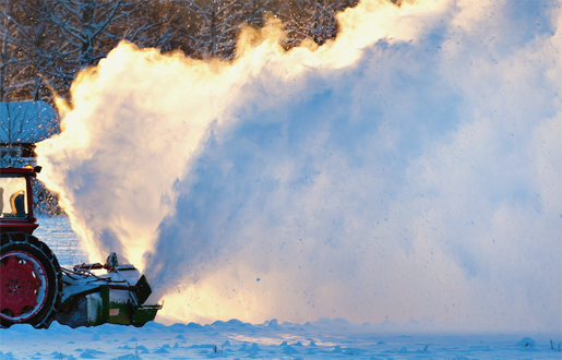
Hochul directs state agencies to prepare emergency response assets, as statewide winter weather system expected to bring heavy snowfall through Friday
√ Winter storm watches and warnings now in effect through Friday for most of state
Gov. Kathy Hochul on Thursday directed state agencies to prepare emergency response assets in advance of a winter storm system expected to bring statewide impacts and heavy rates of snowfall beginning late Thursday night and continuing through Friday evening. The Capital Region and North Country are expected to see the highest snowfall accumulations with the potential for more than a foot of snow. A general 8 to 12 inches of snow is forecast for other parts of the North Country and Capital Region, as well as the Mohawk Valley, Central New York and Finger Lakes Regions. The Southern Tier and Western New York Regions could receive up to 8 inches of snow, while locations in the Mid-Hudson Region could see up to 6 inches.
"Despite the warm weather we experienced earlier in the week, winter is not quite ready to be over here in New York state – and we are preparing for additional snow and ice expected to impact most of the state on Friday," Hochul said. "I have directed state agencies to prepare and deploy emergency response assets to areas where the greatest impacts from this storm are expected. I strongly urge New Yorkers to avoid driving, if possible, during Friday morning's commute, and pay attention to your local weather forecast for impacts throughout the day."
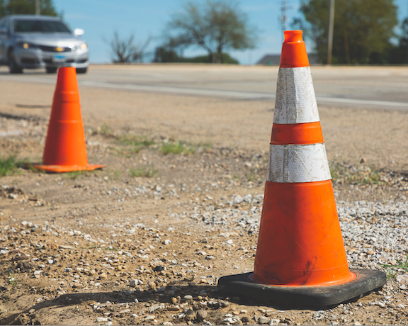
Travel conditions on Friday morning could be difficult, where snow will fall at a rate of 1 to 2 inches per hour, causing reduced visibility on roadways.
Starting around midnight Thursday, a band of snow is forecast to develop and move northeast across the eastern Catskills, then shortly after midnight across the Mohawk Valley, Capital Region and Mid-Hudson Valley. By early Friday, snowfall rates of up to two inches per hour are likely near the I-90 corridor. The weather system is expected to shift north of the I-90 corridor Friday morning with a changeover to sleet and/or freezing rain expected for areas south of I-90, and sleet mixed with snow north of I-90. Precipitation is expected to continue through the afternoon before gradually tapering off from west to east by Friday night.
In parts of Western New York and the Finger Lakes regions, rain and snowmelt is causing water levels to rise on local creeks and rivers. Flood warnings are currently in effect with the threat of minor flooding forecast through Saturday evening for some locations.
State Division of Homeland Security and Emergency Services Commissioner Jackie Bray said, "Many parts of the state will experience up to a foot or more of snow over the next 24 hours. Gov. Hochul and I want New Yorkers to stay home, if possible, on Friday. We encourage anyone in the path of this snowstorm to prepare emergency supplies now in case of a power outage or inability to travel. Let's also remember to check on our vulnerable neighbors and loved ones to make sure they can get through the storm safely."
Multiple weather warnings, watches and advisories have been issued across the state for a variety of potentially hazardous conditions. For a complete listing of weather alerts and forecasts, visit the National Weather Service website at https://alerts.weather.gov.
Agency Preparations
•Division of Homeland Security and Emergency Services emergency operations center will be activated this evening to monitor weather and travel conditions, coordinate state agency response operations, and communicate with local governments ahead of and during the event. The state's stockpiles are prepared to deploy assets to localities to support any storm-related needs, including pumps, chainsaws, sandbags, generators, cots, blankets and bottled water.
•The New York State Department of Transportation is preparing to respond with 3,466 supervisors and operators available statewide. Additionally, 75 incident command system personnel are available to support the response as needed.
All staff members are currently preparing for travel and will be in place by Thursday evening before the onset of precipitation. The need for additional resources, including operators, trucks, mechanics and equipment operator instructors, will be reevaluated as conditions warrant throughout the event.
All residency locations will remain staffed for 24/7 operations throughout the duration of the event and priority cleanup operations.
All available snow and ice equipment is ready to deploy. Fleet mechanics in affected areas will be staffing all main residency locations 24/7 to perform repairs and keep trucks on the road.
Statewide equipment numbers are as follows:
√ 1,750 large and medium-duty plow trucks
√ 48 tow plows
√ 326 loaders
√ 36 snow blowers
Tow services will be utilized at the following locations: I-84 (Orange), I-684 (Putnam), I-81 (Broome), I-88 (Broome), NY 17 (Broome), NY 17 (Sullivan), NY 206 (Delaware), NY 28 (Otsego) and I-88 (Schoharie). Tow services will also be utilized on the Hutchinson River Parkway, Cross County Parkway, Saw Mill River Parkway, Sprain Brook State Parkway and Taconic State Parkway. The need for additional tow services will be reevaluated as the event develops. HELP truck beats and hours of service will be extended during the Friday morning peak traffic period in the Capital District and Mid-Hudson.
Traffic management centers in affected regions will be posting weather-related messages on variable message signs that will be used to support real time incidents and potential vehicle restrictions (if necessary).
For up-to-date travel information, call 511, visit www.511NY.org, or download the free 511NY mobile app.
•The Thruway Authority is ready to respond with 684 operators and supervisors available statewide. Statewide equipment numbers are as follows:
√ 367 large and medium-duty plow trucks
√ 11 tow plows
√ 68 loaders
√ More than 120,000 tons of salt on hand
Variable message signs and social media are utilized to alert motorists of winter weather conditions on the thruway.
The Thruway Authority encourages motorists to download its mobile app, which is available for free on iPhone and Android devices. The app provides motorists direct access to real-time traffic and navigation assistance while on the go. Motorists can also sign up for TRANSalert emails, which provide the latest traffic conditions along the thruway (click here).
•Department of Environmental Conservation police officers, forest rangers, emergency management staff and regional staff are on alert and monitoring the developing situation, and actively patrolling areas and infrastructure impacted by severe weather. All available assets, including sawyers, are positioned to assist with any emergency response.
DEC is advising backcountry users to be aware of and prepared for avalanche conditions due to weather that could increase the risk of avalanches on slides or steep, open terrain. More information is available here.
DEC reminds those responsible for the large-scale removal and disposal of snow to follow best management practices to help reduce the potential for pollutants like salt, sand, oils, trash and other debris in snow from affecting water quality. More information is available here.
•Office of Parks, Recreation and Historic Preservation Park Police and park personnel are on alert and closely monitoring weather conditions and impacts. Park visitors should check parks.ny.gov or call their local park office for the latest updates regarding park hours, openings and closings.
•Department of Public Service: New York's utilities have approximately 5,500 workers available to engage in damage assessment, response and restoration efforts across New York. Agency staff will track utilities' work throughout the event and ensure utilities shift appropriate staffing to regions anticipated to be most impacted.
•New York State Police will be closely monitoring conditions and will be prepared to deploy additional troopers as needed. All State Police four-wheel drive and specialized vehicles, including snowmobiles and utility-terrain vehicles, are staged and ready for immediate response.
•New York Power Authority/Canal Corp. staff is performing preparations to ensure all facilities, assets and equipment are secured and ready. The Power Authority is prepared to support power restoration activities if needed.
Safety Tips: Winter Travel
Per Hochul’s team:
The leading cause of death and injuries during winter storms are transportation-related crashes. Before getting behind the wheel, make sure your vehicle is clear of ice and snow; good vision is key to good driving. Plan your stops and keep more distance between cars. Be extra alert and remember that snowdrifts can hide smaller children. Always match your speed to the road and weather conditions.
It is important for motorists on all roads to note that snowplows travel at speeds up to 35 mph, which in many cases is lower than the posted speed limit, to ensure that salt being dispersed stays in the driving lanes and does not scatter off the roadways. Oftentimes on interstate highways, snowplows will operate side by side, as this is the most efficient and safe way to clear several lanes at one time.
Motorists and pedestrians should also keep in mind that snowplow drivers have limited lines of sight, and the size and weight of snowplows can make it very difficult to maneuver and stop quickly. Snowblowing from behind the plow can severely reduce visibility or cause whiteout conditions. Motorists should not attempt to pass snowplows or follow too closely. The safest place for motorists to drive is well behind the snowplows where the roadway is clear and salted.
Some of the most important tips for safe driving include:
√ When winter storms strike, do not drive unless necessary.
√ Use caution on bridges, as ice can form quicker than on roads.
√ Wet leaves on roadways can cause slippery conditions, making it important to drive at slower speeds when approaching patches of them.
√ Make sure your car is stocked with blankets, a shovel, flashlight and extra batteries, extra warm clothing, set of tire chains, battery booster cables, quick-energy foods and brightly colored cloth to use as a distress flag.
√ Keep your gas tank full to prevent gasoline freeze-up.
√ If you have a cell phone or two-way radio available for your use, keep the battery charged and keep it with you whenever traveling. If you should become stranded, you will be able to call for help, advising rescuers of your location.
√ Make sure someone knows your travel plans.
√ While driving, keep vehicles clear of ice and snow.
√ Plan stops and keep distance between cars. Always match your speed to the road and weather conditions.
For more safety tips, visit the New York State Division of Homeland Security and Emergency Services website at https://www.dhses.ny.gov/safety-and-prevention.


1859 Whitehaven Road, Grand Island, NY 14072
Phone: 716-773-7676
Fax: 716-773-7190
