


+70
°
F
+74°
+58°
Niagara Falls
Thursday, 16
See 7-Day Forecast
Featured News - Current News - Archived News - News Categories

By Joshua Maloni
GM/Managing Editor
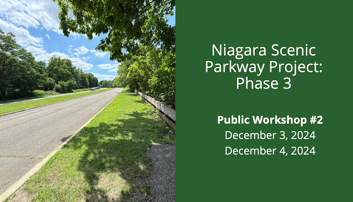
“Traffic calming,” “roundabouts” and “connectivity” were the key words used, as ideas were presented this week on the future – or “reimagining” – of the 5-mile Niagara Scenic Parkway corridor between Findlay Drive in the City of Niagara Falls and Center Street in the Village of Lewiston.
The New York State Office of Parks, Recreation and Historic Preservation continued the scoping process for phase three of this project with public meetings held Tuesday at the Niagara Falls Train Station and then again Wednesday at the Red Brick Municipal Building.
At this point, two options are being considered from an original list offered in 2013: Alternative No. 3, which calls for a reuse of the parkway lanes/parkway alignment through the entire corridor; and alternative No. 4, a meandering park road/sections of complete removal, or combined alignment with Lewiston Road.
A third option, alternative No. 6, which called for full removal of parkway alignment along the gorge, with all vehicles directed to use Lewiston Road, is no longer in the mix.
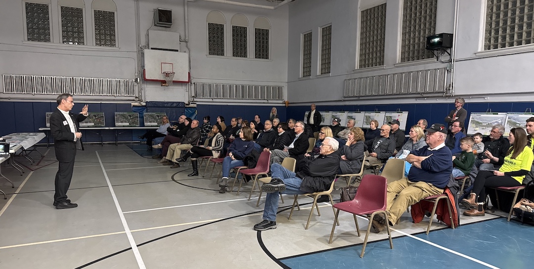
New York State Parks Niagara Region Director Mark Mistretta led the discussion.
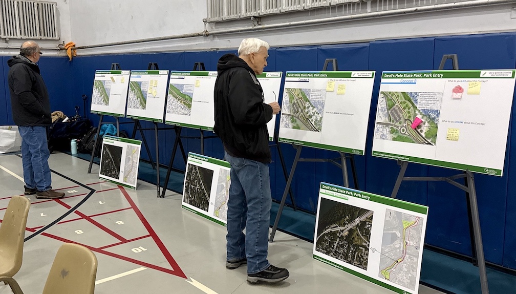
In Lewiston, he explained, “There's a lot of information we’re going to unload on you tonight. We have this high-level overview presentation that we're going to just touch base on these big matters. But what want you to do – the most important part of this meeting – is to spend time after the formal presentation and to look at these (design) boards. We really want you to spend time, ask questions with the people that are from our team with the boards, and make your comments” about the two concepts.
The presentation slides can be downloaded and viewed HERE (PDF).
Perimeters
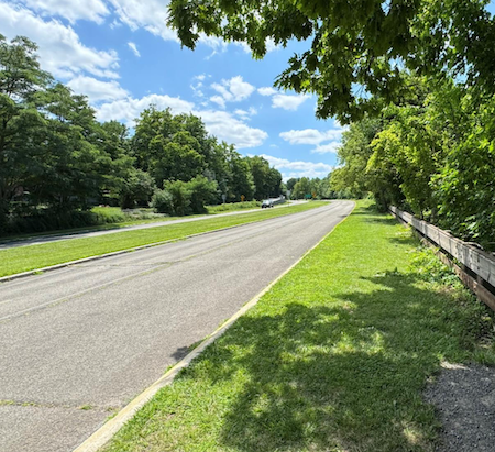
Mistretta said, “This transformative project, that we're excited to talk to you about, is from Whirlpool State Park right through Center Street. That's it. We're not going north of Center Street. We're not touching the parkway north up to Fort Niagara. We're not ripping up any major thoroughfare. Lewiston Road – we’ll not only keep it, but we're going to enhance it, make it safer.
“The former parkway, Scenic Parkway, we are changing that. We're proposing a meandering, scenic park road in its place. We'll have two corridors running parallel – very much like you have now, but with all the work we're doing, they're going to be enhanced. They're going to be safer. They're going to connect more with the community and more with the new green space that we're creating.”
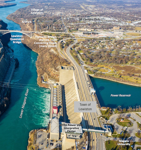
Interaction with New York Power Authority bridge work
State Parks is working with a series of local and state partners, including Colliers Engineering & Design.
Project manager Jessica Ross explained the parkway concept is running concurrently with New York Power Authority plans.
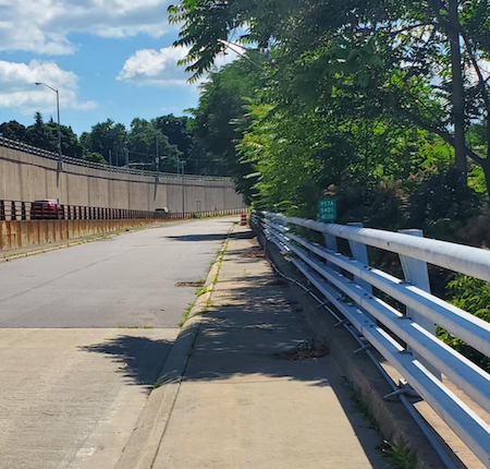
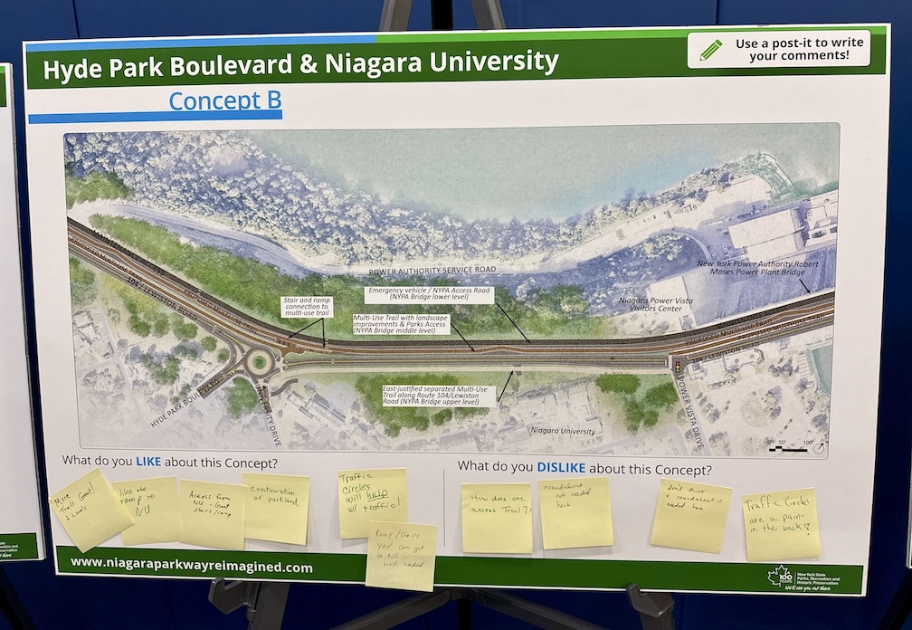
“One of the big coordination points with this project is the separate NYPA Robert Moses Power Station bridges projects,” she said. “It's being heavily coordinated with the Power Authority’s project, which includes replacement of all three bridges. … Lewiston Road and the existing parkway travel lanes are on the top two levels, and they currently support all of our vehicle traffic. And then that third level is home to the existing trail.
“The bridge replacements are slated to begin construction in about 2027, and we do anticipate some overlap with this project in construction. We have been and continue to closely collaborate with NYPA. They are part of our steering committee on construction, staging and how each project can be designed and constructed to complement each other.”
Ross added, “The future vision for this bridge … is we’d like to keep Lewiston Road available to vehicle traffic, but also convert some of that space to multimodal uses, having pedestrian amenities in front of Niagara University and across the bridge, and having a route for bikes to take safely on Lewiston Road, as well.
“The second level … is either going to be parkway lanes or it'll be converted to more green space and a separate trail, and then the third level will be dedicated to NYPA maintenance and emergency access along the gorge.
“Advancing phase three, our team has been working hard over the last several months, and following that federal process to advance conceptual design and scoping for this phase. We focused on updating and evolving the work done in 2013, which was what we had reviewed in (a) February workshop, to the concepts that you will see tonight. And our hope is that, at the end of the scoping process, we can all come to an agreement on one single, preferred, conceptual design.”
Images courtesy of the New York State Office of Parks, Recreation and Historic Preservation.
••••••••
Remaining parkway concepts
Ross noted the two remaining concepts came about following that meeting in February and then “about 30 meetings with our steering committee and our focused stakeholder groups.”
“Based on feedback, there were a few themes that emerged, including establishing connectivity for the neighborhoods adjacent to the gorge and Niagara University; improving access to the Lewiston business district; and traffic-calming and safety improvements on Lewiston Road, as well as the parkway, particularly in the vicinity of neighborhoods like Fort Gray,” she said.
Colliers Engineering & Design Regional Manager Kimberly Baptiste, an urban planner, explained, “The idea of enhancing use of the parkway, creating stronger connections for a variety of users to the waterfront – is not just an idea born out of this process, but is actually reflected in a multitude of community plans that have been developed over the years with Niagara County, with the City of Niagara Falls, and is also identified and addressed in a couple of Village of Lewiston projects: the Village of Lewiston master plan and the village's local waterfront revitalization program. Both stress the importance of improving connectivity and access between the village, surrounding neighborhoods, to the waterfront.”
Based on all of the feedback, Baptiste said the goal is “making sure the corridor is accessible and safe and functional – not just for vehicles, but for pedestrians, for bicyclists, for people in wheelchairs, for people using strollers for public transportation. Multimodal access. Also, improving that connectivity to natural and built destinations, which exist across the 5-mile corridors, but also recognizing we need to maintain regional and local connectivity and provide access for emergency situations, as well.”
She continued, “One of the goals of this meeting, and subsequent stakeholder engagement, is taking these two revised concepts that we have here this evening and refining them into a preferred concept. One of the ways we'll be doing that is looking at your feedback.”
She added, “We'll be looking at how do each of these two concepts support the surrounding neighborhoods. Even though it's a regional corridor – there's lots of visitors that come into the corridor – we also want to recognize that there are neighborhoods adjacent to the corridor, and think about the impacts of the future design on those neighborhoods. How does the design impact and positively complement those neighborhoods. How do the concepts support and expand recreational opportunities, both active and passive. How do each of the concepts support the user experience so it's an enjoyable, welcoming user experience.
“At the same time, thinking about that experience from an accessibility perspective. So, how do each of the concepts – and ultimately the preferred concept – support accessibility. Again, for all of those different types of users in modes of transportation.
“We're also looking at environmental impacts, so the reduction of, for example, impervious surface; potential air quality improvements; looking at public support, so again, taking all of your feedback from this evening into account, as well as our public meeting that we had in the City of Niagara Falls last night, and other stakeholder outreach; safety and operations, again, for all modes of transportation, but also emergency vehicles that may need to access various locations along the corridor.
“And maintenance and cost. Not only looking at short-term costs and implementation of the project, but what are the longer-term costs, from a maintenance and upkeep perspective, as well. Those are all the different criteria that our team will be taking into account as we move forward to provide and ultimately get to a preferred concept.”
Images courtesy of the New York State Office of Parks, Recreation and Historic Preservation.
••••••••
Total removal off the table
As to alternative No. 6, Ross said, “We considered this, along with all of the feedback we got from the February workshop, again, in close coordination with our steering committee members and focus stakeholders. And we came to the determination that this alternative really wasn't feasible for the future of this corridor. Mainly, we want to provide access – that multimodal access – for all. We can't do that without at least keeping some sort of a road alignment. And second off, it's very important to have that maintenance and emergency vehicle access to the gorge at all times.”
Of the two concepts that remain, “These are not set in stone or final by any means. They're very flexible. There are elements in each concept that can be interchanged. So, it's not just all of ‘A’ or all of ‘B.’ ”
She added, “Both concepts do include changing the functionality of the parkway from that expressway-like feel, to the meandering park road at a conventional speed (likely 20-30 miles per hour).”
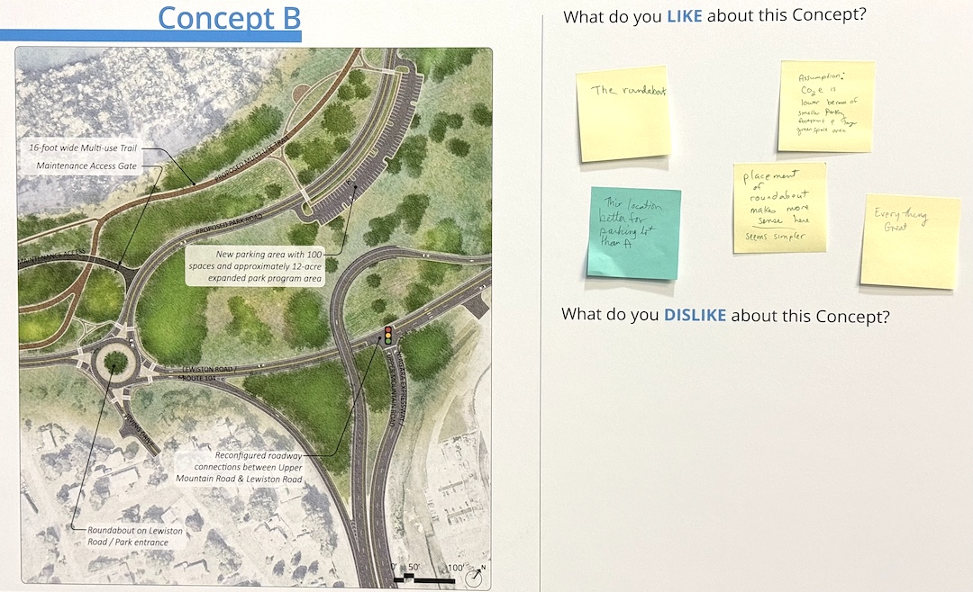
Ross said, “Concept study ‘A’ does include two parallel, separate highway alignments for the integrity of the corridor; so, you'll have two separate, distinct routes all the way from Findley Drive to Center Street. Concept ‘B’ is pretty much the same thing, except between Devils Hole State Park and Irving Drive/Upper Mountain area, the alignments will combine, and all motor vehicles will be on that top level, right adjacent to NU; right adjacent to the Power Vista.”
Ross said, “In concept ‘A’ … as I mentioned, it's two separate alignments. The original parkway lanes are going to be completely removed and replaced with a right-sized multiuse trail and a conventional-speed, meandering park road with narrow lanes and other traffic-calming measures throughout. Lewiston Road is going to receive some traffic-calming improvements throughout the corridor, as well, to complement, again, that corridor mobility: east/west to the gorge, and north/south between Lewiston and Niagara Falls.
“Concept ‘B’ has many of the same improvements, with the exception of that combining of the two roads between Devils Hole and Upper Mountain.”
Ross said, “In the DeVeaux neighborhood, we are exploring multimodal connections, and there are some vehicular connections we are looking at to specific streets. At Devils Hole State Park, we're considering several options for upgrades that are going to improve navigation through the park. They're going to increase parking and maximize green space. And then also between Devils Hole State Park and Upper Mountain, the number of vehicle traffic lanes will be reduced to one in each direction.”
She added, “In both concepts, a roundabout is proposed at the intersection of Hyde Park and University (Drive) and Lewiston Road. … And new trails and sidewalks would properly connect the university's campus to the gorge, the trails and nearby state parks.”
Ross said, “The ramps from Upper Mountain Drive to Lewiston Road and the existing parkway are going to be removed and replaced with a mostly at-grade intersection. This would minimize future maintenance costs, and it would maximize the amount of programmable park space in this area, which is right now taken up by a bunch of ramps.”
Changes at Artpark
She added, “As you get north to Artpark and the Center Street interchange, at Artpark we are looking at putting in a roundabout that's going to serve as the gateway, south of Center, as you travel south past Center Street, into the new park road. It'll provide that built-in traffic calming by slowing everyone down as they approach, and it will provide new connections to Artpark and, in some instances, Lewiston Road via the Creek Road Extension ramp.”
Ross said, “These concepts, it's important to note that they largely retain the existing conditions and important connections to the village at Center Street. This was something we coordinated with the mayor's office, with local police, with Artpark. There were a lot of local voices involved on how exactly this intersection should be, this interchange should be treated, and the fact that, what's there now, it really works for everyone.
“We did look at other options for improvements, and what came down at the end of the day, it was let's keep it; let's improve it, in minor places where we can improve safety and traffic flow. But bottom line is, it looks very similar in these proposed concepts to what it is today.”
Images courtesy of the New York State Office of Parks, Recreation and Historic Preservation.
••••••••
Funding and future steps
Ross said, “We did do a collection of new traffic data and capacity analysis. We proposed upgrades along Lewiston Road to improve congestion and safety, as far as traffic is concerned. And the bottom line is that we are confident that the changes we are making to both Lewiston Road and the park road will support both current and future projected traffic volumes.”
Mistretta noted, “We have funding for this design … but we do not have construction dollars yet. … Our goal after winding up with a preferred concept is that our team goes forward and starts to estimate what is this project going to cost? What is that order of magnitude, approximately?
“Then we take those dollars, that information, and then we start looking for money, while we continue on to those other phases of the project.”
He added, “We intend to, hopefully, have federal money. It is a federal process. And a lot of it will be state money, very much like phases one and two.”
In a press release prior to the meetings, State Parks stated, “The scoping process, which began in early 2024, is considering broad concepts for creating a sensitively configured transportation network along the Niagara Gorge, and will include traffic studies, environmental review, development of design alternatives, and public engagement. The scoping process is expected to wrap up by August 2025.
“While New York State Parks will be the lead agency, the City of Niagara Falls, the Town and Village of Lewiston, the New York State Department of Transportation, USA Niagara and the New York Power Authority will serve as partners.
“More information about the project can be found at www.niagaraparkwayreimagined.com.”
That site also serves as a place where the public can offer additional comments.
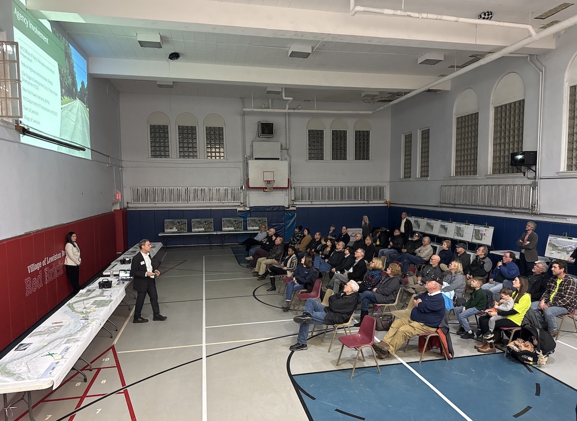
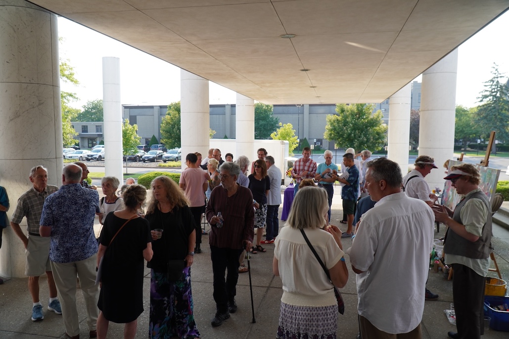
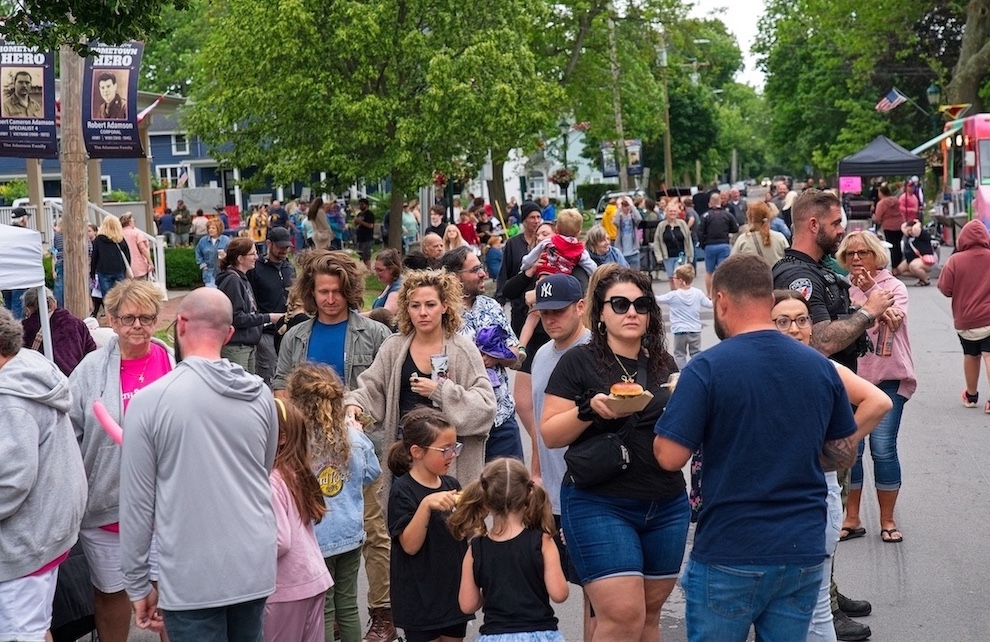
New York State Parks Niagara Region Director Mark Mistretta addresses the Lewiston crowd. Those in attendance were presented conceptual renderings for the Niagara Scenic Parkway corridor leading into the village, and were encouraged to provide feedback right on the poster boards. (Photos by Joshua Maloni)


1859 Whitehaven Road, Grand Island, NY 14072
Phone: 716-773-7676
Fax: 716-773-7190
