


+70
°
F
+74°
+58°
Niagara Falls
Thursday, 16
See 7-Day Forecast
Featured News - Current News - Archived News - News Categories
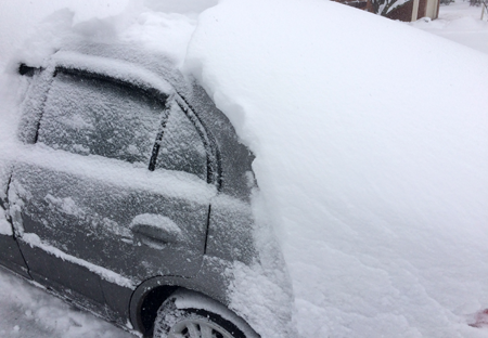
Areas northeast of Lake Erie & Lake Ontario could see up to 18 inches of lake effect snow by Sunday
Strong wind gusts up to 45 mph likely to cause blowing and drifting snow, as well as whiteout conditions
The following information and safety suggestions come from the Office of Gov. Andrew M. Cuomo:
Gov. Andrew Cuomo on Saturday directed state agencies to prepare emergency response assets as two weather systems are forecast to impact the state this weekend, with lake effect snow in Western New York and the North Country today and a coastal snowstorm in New York City and Long Island on Sunday.
In Western New York and the North Country, heavy lake effect snow and high winds will continue tonight with some areas seeing up to 18 inches of snow by tomorrow morning, especially areas northeast of Lake Erie and Lake Ontario. Winds gusting 40 to 45 mph will also result in blowing and drifting snow with near whiteout conditions at times, making travel difficult. In New York City and on Long Island, a coastal low is expected to produce up to 9 inches of snow beginning late tonight and continuing through Sunday afternoon. Travel in these areas will likely be affected by heavy snow conditions during the overnight and morning hours.
"We are right in the thick of winter storm season with an active cycle of weather for the next week or so, which means plenty of opportunities for heavy snow, high winds and potentially hazardous conditions that could impact travel and cause power outages," Cuomo said. "I have directed state agencies to prepare emergency response assets and be ready to assist local partners as needed. As this work is underway, all New Yorkers should keep an eye on their local weather forecasts, use caution when traveling, and follow all warnings from state and local emergency officials."
On Saturday, a low-pressure system drifting northward combined with cold air moving across the upper Great Lakes will continue to produce significant lake effect snow. Strong winds will cause notable blowing and drifting snow, so travelers should be prepared for rapidly changing road conditions and decreased visibilities. A lakeshore flood advisory has also been issued for Erie and Chautauqua counties until this afternoon.
Additionally, a coastal low is expected to bring 4 to 9 inches of snow to the New York City and Long Island area and last through Sunday. The highest snowfall amounts are expected across eastern sections of Long Island, with snowfall rates of 1 inch per hour during the heaviest of the snow and two inches per hour across the twin forks of Long Island. Travel could be difficult at times in impacted areas from late Saturday night through Sunday afternoon. Areas in the lower Mid-Hudson Region could also see 3 to 6 inches of snow, causing slippery road conditions.
An active weather pattern with additional weather systems is forecast to bring more opportunities for snow several times next week to various parts of the state.
Lake effect snow warnings are issued for Erie, Genesee, Jefferson, Lewis, St. Lawrence and Wyoming counties through tonight and winter storm warnings are issued for the New York City/Long Island area through Sunday afternoon. For a complete listing of weather watches and warnings, visit your area's National Weather Service website.
Agency Preparations
•Division of Homeland Security and Emergency Services
The New York State Division of Homeland Security and Emergency Services' emergency operations center remains activated due to the COVID-19 pandemic and will closely monitor weather conditions, coordinate state response operations and remain in contact with localities throughout the duration of the event. State stockpiles are prepared to deploy assets to localities to support any storm-related needs, including pumps, chainsaws, sandbags, generators, cots, blankets and bottled water.
•Department of Transportation
The State Department of Transportation is responding with 3,645 supervisors and operators. statewide equipment numbers are as follows:
•Thruway Authority
The Thruway Authority has 694 operators and supervisors ready to respond with 248 large snowplows, 104 medium snowplows, 11 tow plows and 60 loaders across the state with more than 109,000 tons of road salt on hand. The Thruway Authority has deployed resources west from its Syracuse Division, and Buffalo Division crews will be shifted as needed to where the storm is expected to have a greater impact.
Variable message signs and social media are utilized to alert motorists of winter weather conditions on the thruway. The Thruway Authority encourages motorists to download its mobile app, which is available for free on iPhone and Android devices. The app provides motorists direct access to real-time traffic and navigation assistance while on the go. Motorists can also sign up for TRANSalert emails that provide the latest traffic conditions along the thruway here.
•Department of Environmental Conservation
DEC Environmental Conservation police officers, forest rangers, emergency management staff and regional staff are on alert and monitoring the developing situation and actively patrolling areas and infrastructure likely to be impacted by severe weather. All available assets are positioned to assist with any emergency response.
•Office of Parks, Recreation and Historic Preservation
New York State Park Police and park personnel are on alert and closely monitoring weather conditions and impacts. Park visitors should check parks.ny.gov or call their local park offices for the latest updates regarding park hours, openings and closings.
•Department of Public Service
New York's utilities have approximately 5,500 workers available to engage in damage assessment, response and restoration efforts across New York. Department of Public Service staff will track the utilities' work throughout the storm event and will ensure utilities shift the appropriate staffing to the regions anticipated to be impacted the most.
•New York Power Authority / Canal Corp.
The New York Power Authority and the Canal Corp. staff has performed preparations for the forecasted weather to ensure all facilities, assets and equipment are secured and ready. The Power Authority is prepared to support power restoration activities if needed.
•New York State Police
State Police are prepared to deploy additional troopers as needed to affected areas. All State Police specialized vehicles, including four-wheel drive vehicles, snowmobiles and utility task vehicles, are staged and ready for immediate response. All troop emergency power and communications equipment has been tested.
•Metropolitan Transportation Authority
Metropolitan Transportation Authority is closely monitoring weather conditions to ensure safe, reliable service. MTA employees will be poised to spread salt and clear platforms and stairs of snow and ice, keep signals, switches, and third rail operating.
Customers are encouraged to check new.mta.info for the latest service updates, and to use caution while navigating the system. Customers should also sign up for real-time service alerts via text or email. These alerts are also available via the MTA's apps: MYmta, Metro-North Train Time and Long Island Rail Road Train Time.
•Port Authority
The Port Authority urges motorists to use caution during this weekend's winter storm; speed restrictions may be in effect at the bridges as well as along roadways to and from the crossings.
Travelers through the Port Authority's airports, bus terminal and bus station are encouraged to reach out to carriers and airlines directly for the latest information on delays, cancelations or rebookings. For the latest information about Port Authority facilities, check social media, sign up for PA alerts or download one of the PA mobile apps.
Winter Safety Tips
Some of the most important tips for safe driving include:
√ When winter storms strike, do not drive unless necessary.
√ Use caution on bridges as ice can form quicker than on roads.
√ If you must travel, make sure your car is stocked with survival gear such as blankets, a shovel, flashlight and extra batteries, extra warm clothing, set of tire chains, battery booster cables, quick energy foods and brightly colored cloth to use as a distress flag.
√ If you have a cell phone or other communications device such as a two-way radio available for your use, keep the battery charged and keep it with you whenever traveling. If you should become stranded, you will be able to call for help, advising rescuers of your location.
The leading cause of death and injuries during winter storms is transportation accidents. Before getting behind the wheel, make sure your vehicle is clear of ice and snow; good vision is key to good driving. Plan your stops and keep more distance between cars. Be extra alert and remember that snowdrifts can hide smaller children. Always match your speed to the road and weather conditions.
It is important for motorists on all roads to note that snowplows travel at speeds up to 35 mph, which in many cases is lower than the posted speed limit, to ensure that salt being dispersed stays in the driving lanes and does not scatter off the roadways. Oftentimes on interstate highways, snowplows will operate side by side, as this is the most efficient and safe way to clear several lanes at one time.
Motorists and pedestrians should also keep in mind that snowplow drivers have limited lines of sight, and the size and weight of snowplows can make it very difficult to maneuver and stop quickly. Snow blowing from behind the plow can severely reduce visibility or cause whiteout conditions. Motorists should not attempt to pass snowplows or follow too closely. The safest place for motorists to drive is well behind the snowplows where the roadway is clear and salted.
The above information and safety suggestions came from the Office of Gov. Andrew M. Cuomo.


1859 Whitehaven Road, Grand Island, NY 14072
Phone: 716-773-7676
Fax: 716-773-7190
