


+70
°
F
+74°
+58°
Niagara Falls
Thursday, 16
See 7-Day Forecast
Featured News - Current News - Archived News - News Categories
Travel ban for empty and tandem trucks/trailers to begin Saturday morning on thruway and other state roads in Western New York
√ Governor deploys 100 members of New York National Guard to WNY to support emergency response operations
√ People ‘Encouraged to enjoy Buffalo Bills’ game from home’; those planning to attend should pay close attention to weather and travel updates
√ New Yorkers can subscribe for emergency alerts here
Submitted by the Office of Gov. Kathy Hochul
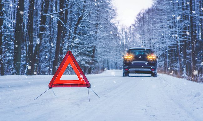
Gov. Kathy Hochul on Friday declared a state of emergency ahead of potentially dangerous and life-threatening blizzard-like conditions forecasted to impact communities along Lake Erie and Lake Ontario.
Areas adjacent to both lakes are forecast to be impacted by strong winds with gusts up to 70 mph that will likely cause power outages, freezing cold wind chills, and lake-effect snow with a foot or more possible in some areas. Blizzard-like, whiteout conditions are possible, especially Saturday night and much of Sunday, and wind chills are forecast to dip into the single digits on Saturday night and remain there through mid-week.
Lake-effect snow is expected for both lakes Erie and Ontario starting Saturday afternoon and continuing through Monday morning, with areas in Western New York and the Watertown area receiving up to a foot of snow. Travel in these areas will be difficult to impossible at times, and New Yorkers are urged to pay close attention to the weather and make plans accordingly to stay safe, especially those planning to attend Sunday’s Buffalo Bills’ game.
New Yorkers are being encouraged to enjoy the game from home; however, if they are planning to attend the game, they should travel with extreme caution and pay very close attention to weather and travel updates throughout the weekend.
“In anticipation of the upcoming storm, I have declared a state of emergency for Western New York, and my administration and I are monitoring the forecast, as well, to see whether that will be necessary for the North Country,” Hochul said. “During this time, it is important to check in on vulnerable friends and family, and do whatever you can to stay safe and warm.”
The state of emergency applies to the following counties: Allegany, Cattaraugus, Cayuga, Chautauqua, Erie, Genesee, Jefferson, Lewis, Livingston, Monroe, Niagara, Ontario, Orleans, Oswego and Wyoming.
Travel Ban for Empty Trucks/Trailers and All Tandem Trucks
Beginning at 9 a.m. Saturday, Jan. 13, the New York State Department of Transportation and New York State Thruway Authority will be issuing a ban on empty trucks/trailers and all tandem trucks on the following routes:
Thruway:
NYSDOT:
Precipitation is expected to begin late this afternoon with areas in New York City, Long Island and the Mid-Hudson seeing rain, while areas to the north and west should see a period of wet snow or snow/sleet mix. Western New York and valley areas in the Finger Lakes, Southern Tier and Capital regions should see snow accumulations before turning to rain. Elevations above 1,500 feet are forecast to receive heavy, wet snow tonight with snowfall rates up to 1 inch per hour at times and wind gusts up to 50 mph, which could lead to downed trees and branches and result in power outages.
In addition, damaging winds with gusts up to 65 mph are expected across Western New York into the Tug Hill, as well as parts of the Mid-Hudson, tonight into Saturday. Winds will be strong across the state with gusts reaching up to 55 mph in places, which will likely result in downed tree and branches – especially where trees are weakened from recent storms.
Western New York will be windy through the day Saturday into Saturday night with gusts up to 70 mph in Erie, Niagara, Orleans, Genesee and Monroe counties, which will likely result in more widespread power outages.
A winter storm watch for heavy lake-effect snow has been issued by NWS Buffalo from Saturday afternoon through Monday morning for areas east of Lakes Erie and Ontario, including parts of Western New York and the North Country. A foot or more of snow possible in the most persistent lake effect bands, and blowing and drifting of snow is likely due to winds gusts up to 70 mph on Saturday afternoon and evening.
In addition, for New York City, Long Island and the Mid-Hudson regions, multiple flood and coastal flood alerts have already been issued for several locations through Saturday. The ground is saturated from recent storms and any additional rainfall may lead to renewed river flooding throughout the day today.
The National Weather Service has issued several additional watches, warnings and advisories for this storm. For a complete listing of weather alerts and forecasts, visit the National Weather Service website at https://alerts.weather.gov. New Yorkers are also encouraged to sign up for emergency alerts by subscribing to NY Alert at https://alert.ny.gov, a free service providing critical emergency information to your cell phone or computer.


1859 Whitehaven Road, Grand Island, NY 14072
Phone: 716-773-7676
Fax: 716-773-7190
