

+70
°
F
+74°
+58°
Niagara Falls
Thursday, 16
See 7-Day Forecast
Featured News - Current News - Archived News - News Categories
In honor of Earth Day, the U.S. Environmental Protection Agency, the Long Island Sound Study (LISS) and the University of Connecticut’s department of marine sciences are announcing the publication of the Long Island Sound Habitat Mapping Initiative website.
The Long Island Sound Habitat Mapping Initiative is a federal, state and academic partnership using cutting-edge technologies to collect data and develop advanced seafloor maps to make better-informed decisions for managing the area. The sound’s diverse seafloor topography supports equally diverse habitats, providing environmental and economic benefits such as recreational and commercial fishing, tourism, marine transportation, wildlife habitat, flood and storm mitigation, and water filtration.
“When Earth Day was created in 1970, the oxygen depletion in the Long Island Sound’s waters was drastically diminishing the fish population and that, along with the physical disruption of the tidal wetlands, was destroying one of the most productive ecosystems in the world,” EPA Region 2 Administrator Pete Lopez said. “Today, the Sound has made remarkable improvements through pollution prevention, stormwater control, and water monitoring. Sharing habitat restoration technology advancements through the new Habitat Mapping Initiative website educates and involves the community in the progress of the Sound’s long-term health and recovery.”
“This new website provides important scientific information about Long Island Sound to the public, which will help create a better understanding of the Sound’s ecosystems,” EPA Region 1 Acting Regional Administrator Deb Szaro said. “This effort demonstrates EPA’s commitment to protect and restore Long Island Sound, as well as the use of sound science and new technology to advance environmental protection.”
“Habitat mapping is crucial for an understanding of how the marine communities of Long Island Sound respond to changing environmental conditions,” said professor J. Evan Ward, head of the department of marine sciences at UConn. “The collaborative mapping efforts are providing critically needed data that will allow us to assess, for example, how communities might be negatively impacted by future climate change or recovering as a result of nutrient mitigation initiatives.”
“What is not seen is often as important, if not more important, than what we can see. Understanding all of the life that the Sound supports is crucial to appreciating and managing this national resource and this website places these previously inaccessible areas of the Sound at the fingertips of scientists, managers and the public,” said Katherine Bunting-Howarth, interim director, New York Sea Grant.
"Data from the mapping initiative has already proved useful in identifying areas of particular ecological significance as part of the Long Island Sound Blue Plan,” said Sylvain De Guise, director, Connecticut Sea Grant and member of the blue plan advisory committee.
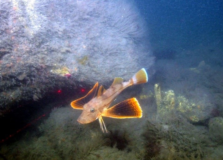
The new website provides background information and goals for the mapping initiative, summaries of ongoing and finished field work, interpretive story maps describing results, and pictures and video illustrating the beauty and complexity of the underwater habitats of the sound.
Funded by the Long Island Sound Cable Fund and administered by the LISS and the Connecticut Department of Energy and Environmental Protection, there are three teams of scientists leading the mapping effort:
•The Long Island Sound Mapping and Research Collaborative (UConn, the University of New Haven and the U.S. Geological Survey).
•The Lamont Doherty Earth Observatory Collaborative (Columbia University, Queens College and Stony Brook University).
•The National Oceanic and Atmospheric Administration (National Centers for Coastal Ocean Science and the Office of Coast Survey).
The Long Island Sound Habitat Mapping Initiative is overseen by EPA, CT DEEP, the New York State Department of Environmental Conservation, the New York Department of State, and the Sea Grant Programs from Connecticut and New York. LISS, developed under EPA’s National Estuary Program, is a cooperative effort between EPA and the states of Connecticut and New York to protect and restore the sound and its ecosystem.
To learn more about the Long Island Sound study, visit www.longislandsoundstudy.net.


1859 Whitehaven Road, Grand Island, NY 14072
Phone: 716-773-7676
Fax: 716-773-7190
