

+70
°
F
+74°
+58°
Niagara Falls
Thursday, 16
See 7-Day Forecast
Featured News - Current News - Archived News - News Categories
At noon Thursday, Aug. 20, New York Sea Grant will offer a free webinar with Scott Steinschneider, Ph.D., of the Cornell University department of biological and environmental engineering, detailing a parcel-level flood forecast risk management tool he has developed for use by communities along Lake Ontario and its embayments. The webinar will be presented via Zoom (www.nyseagrant.org) and Facebook Live (www.facebook.com/nyseagrant).
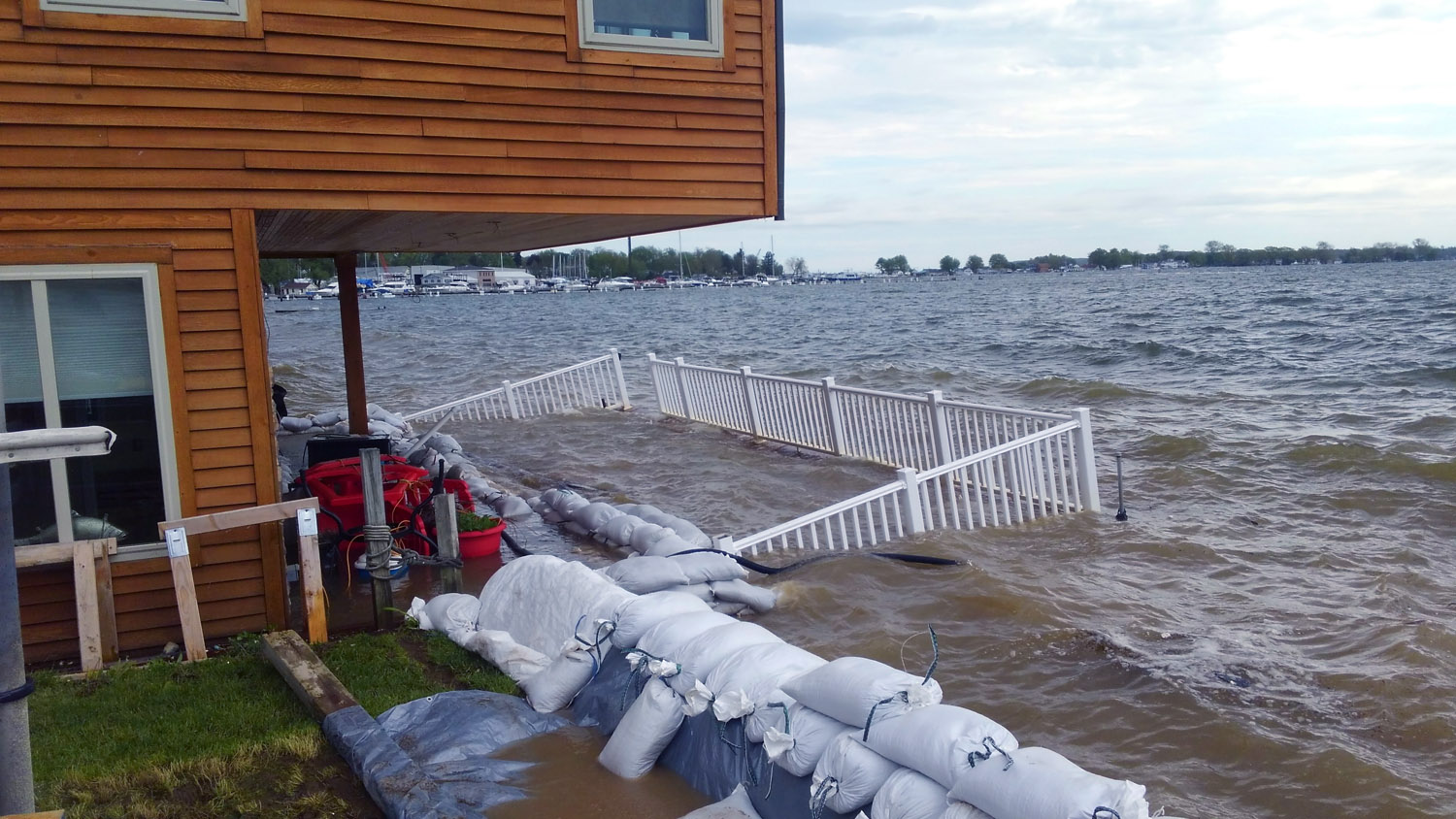
Lake Ontario has experienced two record-setting floods over the course of three years: 2017-19. With funding from New York Sea Grant, Steinschneider has developed an inundation prediction model for rapid flood forecasting at weekly to monthly timescales.
The model was developed with input from stakeholders that included reports and photos of the 2017 Lake Ontario flood damage to manmade structures and natural features; shoreline, bluff and dune erosion; septic and well impact; and power outages.
"The goal of this prediction tool is to provide community planners and property owners with a parcel-level assessment of future flood risk to enhance local short-term preparedness planning and to help inform short-term emergency response," Steinschneider said.
"Dr. Steinschneider's flood risk prediction model is part of New York Sea Grant's ongoing resiliency-building effort to create science-based resources to help Great Lakes shoreline stakeholders better prepare and respond to extreme weather, high water, and intense wave action from storm events," said New York Sea Grant Associate Director Katherine Bunting-Howarth, Ph.D., J.D., assistant director of Cornell Cooperative Extension.
Other New York Sea Grant flood risk management and coastal resiliency-building resources for Lake Ontario shoreline stakeholders are available at www.nyseagrant.org/waterlevel2017. They include:
√ New York's Great Lakes Coastal Resilience Index, a community-level self-assessment tool for municipal leaders, local planners, engineers, flood plain managers and others to guide resiliency planning to manage coastal hazards and weather events; authored by New York Sea Grant Coastal Community Development Specialist Mary Austerman;
√ An interactive, parcel-level inundation mapping tool;
√ An online story with aerial photos of the 2017 flooding impact along Lake Ontario from Braddock Bay west of Rochester to Stony Creek near the mouth of the St. Lawrence River;
√ A photo gallery with images from 32 communities across the seven-county Lake Ontario region; and
√ A summary of the American Planning Association award-winning post-flood recovery building workshop, organized by New York Sea Grant and the Genesee/Finger Lakes Regional Planning Council, for the Village of Sodus Point.
The Aug. 20 "A Probabilistic, Parcel-Level Inundation Prediction Tool to Support Community Preparedness to Flooding along Lake Ontario" webinar is part of New York Sea Grant's summer 2020 virtual seminar series. Recordings and additional information on previous and forthcoming seminars can be found at www.nyseagrant.org/researchseminars.
New York Sea Grant is a National Oceanic and Atmospheric Administration cooperative program of Cornell University and the State University of New York with Great Lakes offices in Oswego, Newark and Buffalo. Learn more at www.nyseagrant.org.


1859 Whitehaven Road, Grand Island, NY 14072
Phone: 716-773-7676
Fax: 716-773-7190
